NORWAY 1996 |
||
| Home > Travel > Norway > Norway 1996 | ||
| This is a travel description of a trip to the southwestern part of Norway in 1996. I made the trip together with my dad. | ||
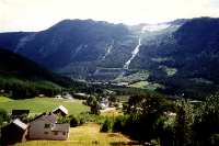
| Most of the first day was used to get to Norway - the fast ferry was cancelled because of too much wind, so we had to the the normal ferry to Larvik. We arrived in Larvik late at night and was lucky to get a cabin a little outside Larvik. | The next day vi drove west through Evje to Tonstad. In Tonstad we continued north up Sirdalen (Sir valley). In the upper part of Sirdalen we took the road to Lysebotn that lays at the end of Lysefjorden. The weather: it started fine, but in the evening it was raining. | 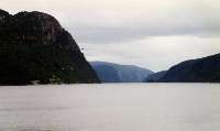
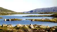
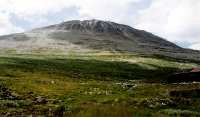
Tonstad |
 Tonstad (34 kb) |
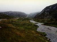
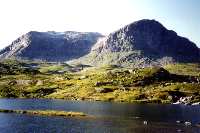
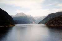
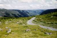
 Sirdalen |
 Sirdalen |
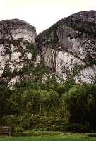
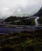
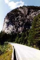
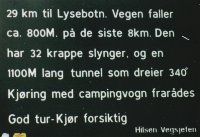 The road to Lysebotn is an experience - there's a tunnel turning 340 degrees |
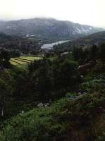 Heading for Lysebotn |
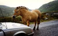
Suddenly there was a horse standing in the middle of the road... |
 Over the plateau to Lysebotn |
 The road climbs down to Lysebotn |
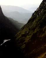
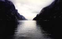 The Lyse fiord seen from Lysebotn (21 kb) |
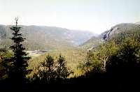
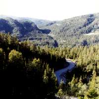
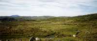
| The following day the weather was fine. We went over Urvassheia, the mountains that separates Sirdalen and Setesdalen. Then up through Setesdalen to Haukeligrend and over Haukeligfjell. The end destination this day was Odda in the bottom of Sørfjorden. | 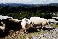 Sheeps on Urvassheia |
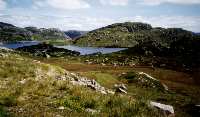 Urvassheia (60 kb) |
 The Setesdal a little north of Valle (51 kb) |
 View over the Setesdal from the Setesdal museum (42 kb) |
 Going down to Haukeligrend (40 kb) |
 Going down to Haukeligrend (41 kb) |
 Going over Haukeligfjell (50 kb) |
 View over Haukeligfjell |
 Seljestad with the glacier Folgafonna in the background - probably the best view on the trip! (24 kb) |
||
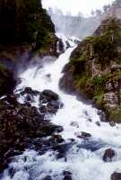
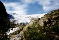
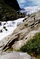
| One of the arms of the Folgafonna glacier is the Buar glacier - it is close to Odda, so the next day we went to see the glacier. | 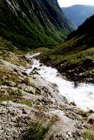 Water from the glacier (68 kb) |
 More running water (44 kb) |
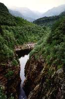
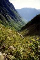 The Buar valley (62 kb) |
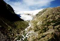 The edge of the Buar glacier |
 The edge of the Buar glacier |
 The edge of the Buar glacier (66 kb) |
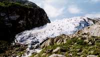
 The Buar glacier (63 kb) |
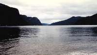
 After having seen the Buar glacier we continued up along Sørfjorden (52 kb) |
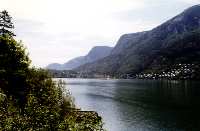
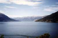 Sørfjorden (35 kb) |
 Sørfjorden and Øsafjorden (32 kb) |
 We continued up through the Måbø valley to Hardangervidda. In the distance the glacier Hardangerjøkulen can be seen (44 kb) |
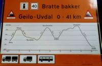 As this sign shows we meet som steep hills from Geilo south to Uvdal (Uvdal is on the way to Rjukan) |
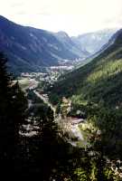 And finally we arrived in Rjukan (40 kb) |
 South of Rjukan is Gaustatoppen with an altitude of 1883 m (43 kb) |
 View from Gausta (64 kb) |
||