NORWAY BY BIKE 1997 |
| Home > Travel > Norway > Norway 1997 > Bergen | Norway 1997 subpages
Bergen From Bergen to Øvre Eidfjord Hardangervidda Rallarvegen to Flåm Home from Flåm |
|||
Over Hardangervidda | ||||
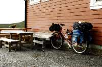
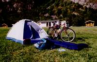 My tent and bike in Øvre Eidfjord |
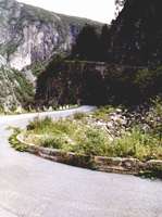
Even though I had allready fought som climbs it was nothing compared to the climb from the Hardanger Fjord to Hardangarvidda - a plateau with an altitude of about 1000 - 1200 m. It was up through the Måbö valley. And it was indeed a struggle - but I made it. A good thing is that bikes can take the old road with no car traffic as cars take the new road built a few years ago. | 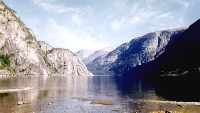 The view from the camping site. The water is actually a dammed lake (70 kb) |
||
 Heading for the top |
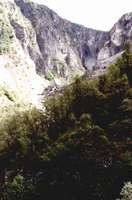 The upper part of the Måbö valley. Straight ahead is the waterfall Vöringsfossen - one of the most famous in Norway. |
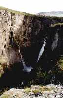 Vöringsfossen (84 kb) | ||
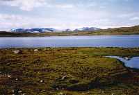 From Hardangervidda you can see the glacier Hardanger-jökulen (92 kb) |
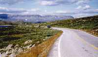
On the way up to the plateau Hardangervidda you pass Vøringsfossen, one of the most famous waterfalls in Norway. The water falls 145 m. | 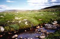 Hardangervidda | ||
 "Pitstop" at Dyranut on Hardangervidda |
On Hardangervidda, at a place kalled Dyranut, is a place where you can get a small lunch - it's a kind of cafeteria. I had decided to try something typical norwegian, and on the high plateaus in Norway you eat "rømmegrød". So I of course ordered "rømmegrød" | 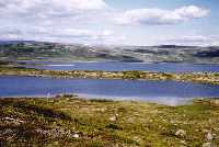 Hardangervidda | ||
 Hallingskarvet in the background |
When you go eastwards on Hardangervidda you can se a characteristic mountain in the distance. It is Hallingskarvet, 1930 m high, which means it's 800 - 900 m higher than the surrounding terrain. |  Sheeps on the road - they are not afraid of motorized trafik - a large truck driving by doesn't bother them - but a bicykle is rare and they fell worried. | ||
| Late afternoon I arrived in Haugastøl. Haugastøl is the startpoint for "Rallarvegen" which is a dirt road used for building the railway to Bergen. Today the road is used for biking and trekking and normal traffic is not allowed. After 15-20 km I found a place to put up my tent, in the middle of "nowhere". | ||||