SWEDEN & NORWAY AUGUST 2000 |
| Home > Travel > Norway > Norway & Sweden 2000 > Page 2 | Norway 2000 subpages
København - Southern Norway - Northern Sweden > Kiruna - Norway/Ofoten Nordland - Trondheim Trondheim - Stryn Briksdalsbreen Sognefjellet | |
August 11, 2000: Kiruna - Norway/Ofoten | ||
| Kiruna is known for its mine - the mine is actually the largest underground mine in the world. There's guided tours into the mine, so I joined one of these tours. It was an exiting experience - the mine is enormous - there are about 400 km of road and the deepest point of the mine is about 1,000 m below the surface - this means that the deepest point also is quite a bit below sea-level. | 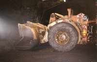 A machine now retired from normal use. Today the machine is to small, and is replaced by bigger ones. But this one is used to show how mining is done.. |
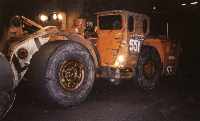 Same machine seen from another angle. (30 kb) |
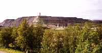 The mine seen from Kiruna - more unusual than pretty |
The iron ore is about 100 m thick and 4000 m wide. The ore is almost vertical and has a depth of at least 2000 m. | 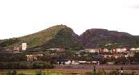 Another mine in Kiruna |
| After having seen Kiruna and the mine I continued to Norway. The road between Kiruna and Norway (Narvik) goes over a pass at Riksgrensen (the border). Here I for the first time on my trip saw snowcovered mountains. In this area you'll also find the highest mountain i Sweden, Kebnekaise, 2111 m high.
My destination was a camping site at the junction between E10 from Kiruna and E6, that goes north - south (actually it goes from southern Sweden to northern Norway). |
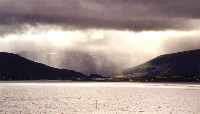
 The wiev from the camping site |
 "Heavy" weather (45 kb) |
August 12 - August 13, 2000: Ofoten | ||
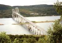 The Tjellsund bridge |
 An almost heavenly light (57 kb) |
The next day I saw the Ofoten islands. Ofoten is the islands between mainland Norway and Lofotoen. But I didn't see that much because it was raining more or less all day, so it was a little depressing.
In the evening I visited some friends of mine that lives between Narvik and Tromsø. It was very cosy to visit them. |
| This was the northernmost point on this trip - the next day I started my tour back to Denmark. This day the weather was nice and sunny, even though it was also partly clouded.
On my way back I stopped in Narvik and saw almost everything there is to see (not much). It took a couple of hours and then I continued south. I did see some of the big ore trains |
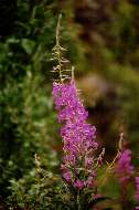 Flowers like this is very common in northern Norway |
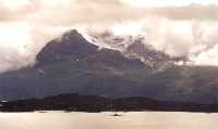
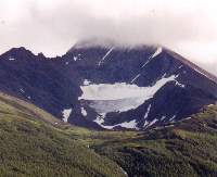 Circus glacier |
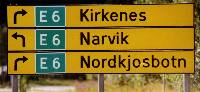
| For the next 1000 km or so I followed the E6 - the main (and only) road between southern and northern Norway. Even though it is the only main road, the standard isn't very high, at least on some parts. Often the road is narrow and with bad visibility because of turns and/or hill tops. |
|
 Rock formation |
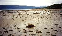 What I didn't know, is that there is a quite extreme tide in the Lofoten/Narvik area. Here is a typical tidal coast just south of Narvik. |
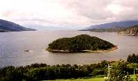
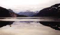
South of Narvik is a quite distinctive landscape with fiord and sharp mountainpeaks - just like the pictures I have seen from Lofoten. See my pictures: | 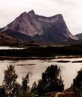 Efjorden south of Narvik |
 Another picture from Efjorden (46 kb) |
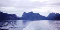 South of Narvik the E6 "goes by ferry" over Tysfjorden - this picture is taken from the ferry (44 kb) | |