NORWAY 2002 |
| Home > Travel > Norway > Norway 2002 > Sognefjellet | Norway 2002 subpages
From Oslo to Bergen Bergen From Bergen to Sognefjorden > Sognefjellet Valdres Map | |
Sognefjellet | ||
| The next morning we woke up with a beautiful view over Sognefjorden. We continued through Sogndal and Luster to Sognefjellet. In the bottom of the Lustra fiord, in Skolden, the climb up to Sognefjellet began. The highest point on the road over Sognefjellet is 1434 m above sealevel. | 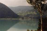 Luster (75 kb) |
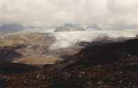 The Smørstabb glacier seen from Sognefjellet (68 kb) |
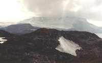 Sognefjellet - on the left Fannaråken (2068 m) and on the right Steindalsnosi (2025 m) (57 kb) |
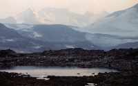 Skagastøls-/Styggedalsryggen seen in the light of the sun setting. From the left is Jervvasstind (2351 m), Styggedalstind (2387 m), Sentraltind (2348 m), Vesle (2340 m) and Store Skagastølstind (2405 m). The distance is about 12 km, so the picture is taken with a zoom lens. (62 kb) |
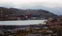 Sognefjellet - Sognefjellshytta (75 kb) |
| We got a room at Sognefjellshytta. I stayed here on my trip in 2000, where I found the place to be worth coming back to. This time I was a bit disapointed - the dinner meal was not so exiting as we had tried other places and the place was almost empty - it was in the end of the season.
Compared to year 2000 there was hardly any snow on Sognefjellet. Normally there is quite a lot of snow also in the summertime because of the height, but in 2002 there was very little snow. See more pictures from my trip to Sognefjellet in year 2000 |
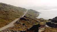 Sognefjellet - RV 55 over Sognefjellet (85 kb) |
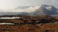 Sognefjellet - Fannaråken and Steindalsnosi again, this time in more clear weather the next morning (90 kb) |